Flight V44 – Ariane opens up a new window on our world with ERS-1
19.07.2021

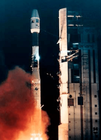
On July 17, 1991, Ariane 4 launched not just a satellite but a whole new perspective on how we can understand and protect our planet.
At the time of its launch on Ariane Flight 44, ERS-1, the first European Remote Sensing satellite, was the most sophisticated Earth observation spacecraft developed and deployed in Europe. It carried a ground-breaking suite of cutting-edge instruments for collecting data on the Earth’s atmosphere, land surfaces, oceans, and polar caps which would be invaluable for multiple sectors ranging from agriculture, land-use changes, urban development, to international monitoring, marine surveillance, pollution monitoring.
Ariane 4 launch of ERS-1 © ESA/Arianespace
ERS-1 had radar instruments which allowed it to collect data regardless of weather conditions or cloud coverage, day or night.
Topographical map of Alaska from ERS-1 SAR data © ESA
ERS-1 was the first European Space Agency mission launched into a sun-synchronous (SSO) orbit. As the name implies, this means that the satellite in operation flies around the Earth “in synch” with the Sun, such that it passes over any given point on the planet’s surface every day at the same local time, and, therefore, the sunlight conditions are the same for each passage.
A data-collecting satellite in a sun-synchronous orbit can provide invaluable information on changes taking place over time at any particular area.
At each sweep of the globe, ERS-1 took a 4,000-km x 100-km swath of the Earth’s surface, generating images at a resolution of 30 m.
In a testimony to the modularity underpinning the Ariane concept, for this launch, the Ariane the SSO-specific 40 variant, operated seven times, was employed.
Ariane 4 with ERS-1 readying for launch © ESA/Arianespace
ERS-1 was joined in orbit four years later by its near-twin ERS-2, also launched by Ariane, and the two performed a tandem mission collecting a wealth of fundamental data on the Earth’s land surfaces, oceans, and polar caps, instrumental in revolutionizing understanding of the state of our planet and informing critical debate.
Today, hundreds of research groups around the world use ERS data in their studies. For 20 years, the ERS missions made substantial contributions to advance science, technology and applications for Earth observation.
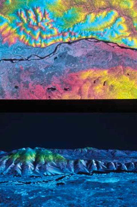
ERS-1 first synthetic aperture (SAR) radar image, July 27, 1991, Netherlands © ESA
Guaranteeing access to space to continue this endeavor to better understand and monitor our Earth is essential.